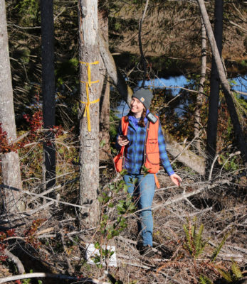
In the weeks before the “Stay Home, Stay Healthy” order, Great Peninsula Conservancy’s Stewardship Associate Ali Erskine completed a baseline report for The Trust for Public Land at the Dewatto Headwaters Forest on Hood Canal in Mason County. For four days she walked the boundary of this 2,154-acre property, always with a GPC colleague or volunteer steward to maintain best safety practices. Here she answers a few questions about the purpose and protocols of baseline reports and how they’re used to protect conservation easements.
Why did The Trust for Public Land (TPL) partner with Great Peninsula Conservancy (GPC) on this project?
While GPC is a land trust that works in local region, TPL works nationwide with partners in many regions. Because this project is in GPC’s working region, we know the area well and regularly create baselines and management plans in this region – TPL was kind enough to let us be part of this project and contracted GPC to do some on-the-ground work and create the baseline report.
What’s the scope of the project?
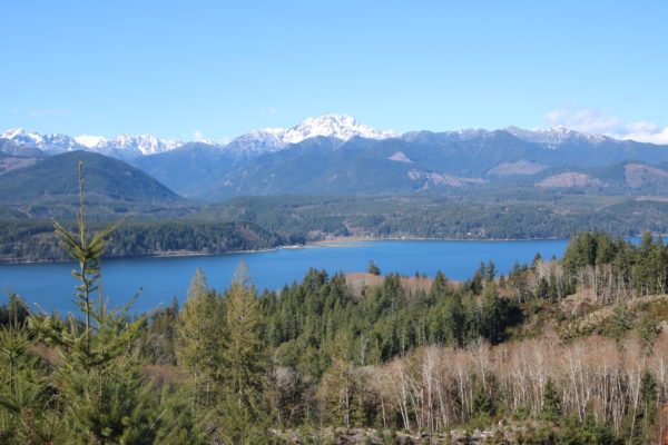
The Dewatto Headwaters Forest is a very cool project between The Trust for Public Land and Pope Resources that will conserve this land through the US Forest Service’s Legacy Forest Program, which aims to stop the loss and fragmentation of forest landscapes by protecting forestland. This easement requires that this land remains in forestry forever, promising our region thousands of acres free from development.
What does a baseline report entail? What is its main function and how does it advise future management?
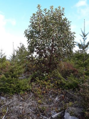
A baseline report is meant to be a snapshot of a property at the time that a conservation easement is made. Conservation easements protect what are referred to as “conservation values,” or the elements of the property that are protected by the easement. These can be anything, depending on the easement, from water resources to forests to feeder bluffs. A baseline report should capture these conservation values in photos, maps, statistics, and descriptions, such that in one hundred years anyone working with the property and easement will know what the easement was made to protect.
What tools do you use?
We use Landscape, a GPS-tracking software made specifically for land trusts. Landscape allows us to navigate the property and take georeferenced photos of the property in the field, saving us a lot of time and transcription back at the office. I also always have a paper map and compass in the field just in case.
What are the conservation values of the Dewatto Headwaters Forest and what species did you observe?
The value of keeping this land as a working forest is huge. By keeping thousands of acres of non-impervious (non-paved) surfaces in the Hood Canal watershed, we keep natural systems for water filtration through soils, streams, and wetlands, which is good for our water and salmon. By keeping this landscape-scale, contiguous open space, we provide a large area for mammals like deer, bear, and cougars to roam (and not show up in our backyards). And, of course, we keep a local industry that produces renewable resources, which is good for people!
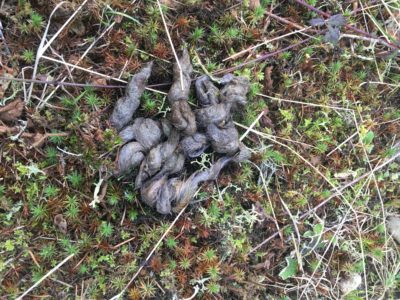
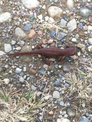
While we didn’t see any bears or cougars, we did see hawks, bald eagles, rough-skinned newts, and more!
Is GPC working on similar properties in the area?
GPC’s Hahobas Shoreline Preserve, which we acquired last year, is in the same watershed! Our preserve is 162 acres of shoreline and forestland that will also be free of development forever! We are busy planning restoration along the shoreline to improve salmon habitat, and we’re also working on a plan to improve the forest health of the uplands. Stay tuned for some very cool stewardship updates at Hahobas!
What were the pros and cons of walking a property for 4 days at 8+ hours a day with your colleagues?
Spending long field days with your coworkers opens up a LOT of time for chatting. You really get to know each other, and learn surprising things you would never have known otherwise – like who secretly loves demolition derbies and who packs the best snacks. I’m lucky that everyone on the GPC staff is willing to walk ten or more miles a day in the woods and to go just a little bit further for one more photo point at the end of the day.